


-
Product DescriptionCompany Info.<>
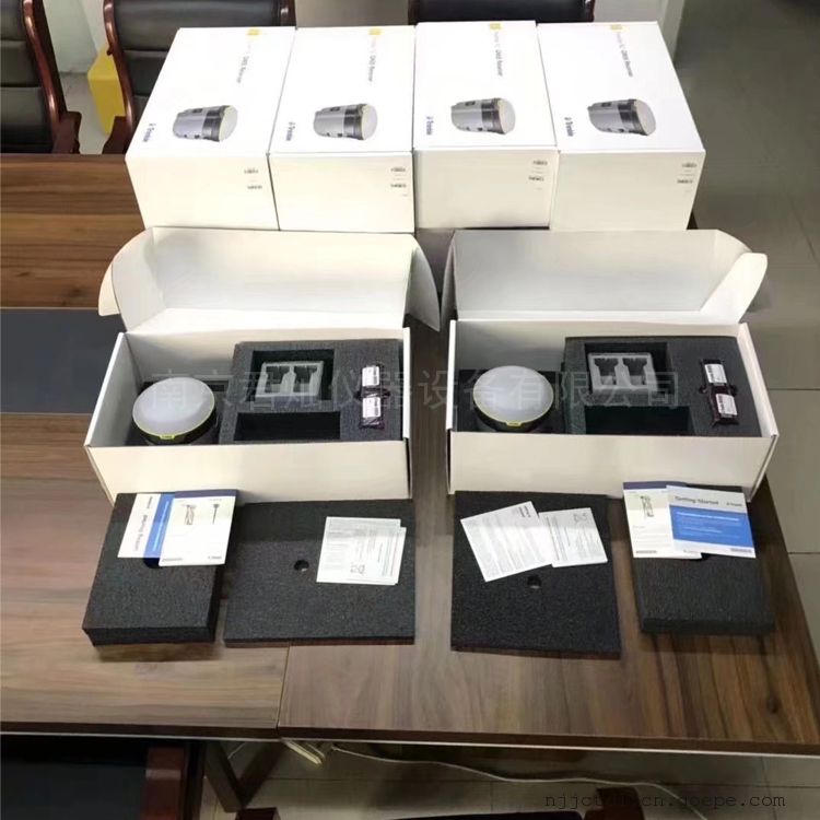
- Model:
- R2
- Place of origin:
- import
- Memory:
- 8G
- GPS positioning accuracy:
- centimeter-level
Trimble R2 imported RTK surveying instrument main features
1. A solution for surveying and mapping geographic information applications with accuracy ranging from sub-meter to centimeter, supporting any GIS or survey-level workflow
2. Easily collect data using Trimble measurement and GIS software by pairing with devices such as smartphones, tablets or Trimble handsets
3. Quick setup, easy to use, allowing you to complete tasks with high productivity and concentration
4. Support multiple satellite systems and differential correction sources, and obtain data from any location
Trimble Maxwell 6 chip 220 channels and GNSS technology to maximize data quality
6. Universal field equipment, flexible to adapt to your workflow
Use the Trimble R2 GNSS receiver to work the way you want. The R2 receiver features trusted Trimble technology, allowing you to freely configure your solution to suit your application by selecting accuracy and GNSS performance. Trimble R2 is capable of sub-meter to centimeter-level positioning accuracy, allowing you to work efficiently in different mapping geo-information application environments regardless of workflow requirements.
Trimble R2 can perform tower lofting, survey in roads, mines or construction sites, locate underground assets (such as pipelines and cables), capture GIS field assets, and conduct precision survey surveys. It is a general purpose device designed for surveyors and mapping and GIS personnel and the like
Trimble R2 is simple to install and easy to use, and can be used with any Trimble handset, Trimble Access controller, or consumer smart device on a variety of operating systems and platforms to deliver reliable, high-quality data in real time every time.

8. Simple and robust system to meet daily needs
Built to withstand the rigors of the outdoors, the rugged IP65 Trimble R2 receiver will work with you in harsh outdoor environments. One-button start and compact, simple form factor allow it to be quickly installed and operated, either on a pole or in a backpack or car. Field replaceable batteries keep you running uninterrupted throughout the day, allowing you to focus on the work at hand.
9. Science and technology bring high yield
Trimble R2 is capable of tracking all GNSS satellite systems and augmentations and comes standard with an integrated Trimble Maxwell 6 chip and 220 channels, giving you reliable accuracy and positioning capabilities. From traditional RTK and VRS networks to Trimble RTX correction services via satellite and the Internet, you have the flexibility to select correction sources for higher real-time accuracy. Trimble has developed Floodlight satellite shadow cancellation technology to ensure that the R2 receiver can provide reliable and accurate data even in poor GNSS environments. Equipped with this advanced GNSS technology, even if large canopy and buildings above block satellite signals, positioning ability and accuracy can be significantly improved, making it easy to smooth out the difficult GIS workflow.
10. Complete solution
Connect the Trimble R2 receiver to the controller or mobile device you want to use via a wireless Bluetooth connection or USB cable, and add Trimble's proven field and office software workflows to complete the solution. Data collection can be done through customizable workflows in Trimble field software (e.g. Trimble Access or Trimble TerraFlex software), allowing your team to easily collect and exchange information between field and office in real time. The collected data can then be processed with Trimble in-house software, including Trimble Business Center or TerraFlex, allowing you to deliver data-rich, high-quality results for your company. For a simple, configurable field-to-office solution, the innovative and flexible Trimble R2 GNSS receiver enables you to work in an efficient manner.
Configuration options
type. . . . . . . . . . . . . . . . . . . . . . . . . . . . . . . . . . . . . . . . . . . . . . . . . . . smart antenna
Static operation. . . . . . . . . . . . . . . . . . . . . . . . . . . . . . . . . . . . . . . . . . . . . . . . . . . support
Mobile station operations. . . . . . . . . . . . . . . . . . . . . . . . . . . . . . . . . . . . . . . . . . . . . . . . . support
Rover location update rate. . . . . . . . . . . . . . . . . . . . . . . . . . . . . . . . . 1 Hz、2 Hz、5 Hz
VRS Now rover operations within the network. . . . . . . . . . . . . . . . . . . . . . . . . . . . . . . . . support
measurement
Advanced Trimble Maxwell 6 custom GNSS chip
2. High-precision multi-correlator for L1/L2 pseudorange measurement
Unfiltered and smoothed pseudorange observation data for low noise, low multipath error, low temporal correlation and high dynamic response
4. Very low noise carrier phase measurement, 1Hz bandwidth sampling accuracy 1mm
Signal to noise ratio reported in dB-Hz
6. Trimble EVEREST Multipath Signal Suppression
7. Proven Trimble low altitude angle tracking technology
8, 220 channel GNSS
9, 4 channel SBAS(WAAS/EGNOS/MSAS)
positioning performance
SBAS(WAAS/EGNOS/MSAS) Location 1
Horizontal accuracy. . . . . . . . . . . . . . . . . . . . . . . . . . . . . . . . . . . . . . . . . . . . . . . . ±0.50 m
Vertical accuracy. . . . . . . . . . . . . . . . . . . . . . . . . . . . . . . . . . . . . . . . . . . . . . . . ±0.85 m
Code differential GPS positioning 2
Type of correction. . . . . . . . . . . . . . . . . . . . . . . . . . . . . . . . . . . . . . . . . . DGPS RTCM 2.x
Corrected source. . . . . . . . . . . . . . . . . . . . . . . . . . . . . . . . . . . . . . . . . . . . . . . . . . . . . IBSS
Horizontal accuracy. . . . . . . . . . . . . . . . . . . . . . . . . . . . . . . . . . . ±(0.25 m + 1 ppm) RMS
Vertical accuracy. . . . . . . . . . . . . . . . . . . . . . . . . . . . . . . . . . . ±(0.50 m + 1 ppm) RMS
RTX location in 3, 5.
CenterPoint® RTX
Horizontal accuracy. . . . . . . . . . . . . . . . . . . . . . . . . . . . . . . . . . . . . . . . . . . . . . . . . 4 cm
Vertical accuracy. . . . . . . . . . . . . . . . . . . . . . . . . . . . . . . . . . . . . . . . . . . . . . . . . 9 cm
RangePoint™ RTX . . . . . . . . . . . . . . . . . . . . . . . . . . . . . . . . . . . . . . . Horizontal 30 cm
ViewPoint RTX™ . . . . . . . . . . . . . . . . . . . . . . . . . . . . . . . . . . . . . . . . Horizontal 60 cm
OmniSTAR Positioning 4®
VBS service accuracy. . . . . . . . . . . . . . . . . . . . . . . . . . . . . . . . . . . . . . . . . . . . . . .& lt;1 m
XP service accuracy. . . . . . . . . . . . . . . . . . . . . . . . . . . . . . . . . . . . . . . . . . . . . . 8–10 cm
HP Service Accuracy. . . . . . . . . . . . . . . . . . . . . . . . . . . . . . . . . . . . . . . . . . . . . . 5–10 cm
G2 . . . . . . . . . . . . . . . . . . . . . . . . . . . . . . . . . . . . . . . . . . . . . . . . . . . . . 8–10 cm
RTK Positioning 2
Horizontal accuracy. . . . . . . . . . . . . . . . . . . . . . . . . . . . . . . . . . . . . 10 mm + 1 ppm RMS
Vertical accuracy. . . . . . . . . . . . . . . . . . . . . . . . . . . . . . . . . . . . . 20 mm + 1 ppm RMS
Network RTK2
Horizontal accuracy. . . . . . . . . . . . . . . . . . . . . . . . . . . . . . . . . . . . . 10 mm + 1 ppm RMS
Vertical accuracy. . . . . . . . . . . . . . . . . . . . . . . . . . . . . . . . . . . . . 20 mm + 1 ppm RMS
Battery and power consumption
Built-in. . . . . . . . . . . . . . . . . . . . . . . . . . . . . Removable built-in lithium battery 7.4V, 2800 mAh
External. . . . . . . . . . . . . . . . . . . . . . . . . . . . . . Mini B USB port input power, non-rechargeable
10W USB adapter per standard
power consumption. . . . . . . . . . . . . . . . . . . . . . . . . . . 4.95W (VFD 100%)、3.7W(VFD 12.5%)
18V power supply, rover mode
Built-in battery operating time
Mobile station. . . . . . . . . . . . . . . . . . . . . . . . . . . . . . . . . . . . . . . 5 hours; varies with temperature
mechanical specifications
user interface. . . . . . . . . . . . . . . . . . . . . . . . . . . . . . . . . . LED indicator shows receiver status
On/off key One-touch start
size. . . . . . . . . . . . . . . . . . . . . . . . . . . . . . . . . . . . . . . . Diameter 14.0cm x Height 11.4cm
weight. . . . . . . . . . . . . . . . . . . . . . . . . . . . . . . . . . . . . . . . . . . . 1.08kg receiver net weight
environmental specifications
temperature
work. . . . . . . . . . . . . . . . . . . . . . . . . . . . . . . . . . . . . . . . . . . –20 C to +55 C
Deposit. . . . . . . . . . . . . . . . . . . . . . . . . . . . . . . . . . . . . . . . . . . –40 C to +75 C
Humidity. . . . . . . . . . . . . . . . . . . . . . . . . . . . . . . . . . . . . . . . . . . . . . . . . 100% coagulation
Waterproof. . . . . . . . . . . . . . . . . . . . . . . . . . . . . . . . . . . . . . . . . . . . . . . . . . . . . . . . IP65
The measuring rod falls. . . . . . . . . Withstands drops from 2m to any flat and angular concrete floor (25C)
strike
Not working. . . . . . . . . . . . . . . . . . . . . . . . . . . . . . . . . . . . Up to 75g, 6ms, sawtooth
work. . . . . . . . . . . . . . . . . . . . . . . . . . . . . . . . . . . . . Up to 40g, 10ms, sawtooth
100 impacts at 2Hz
vibration. . . . . . . . . . . . . . . . . . . MIL-STD-810G (in service), Test Method 514.6, Step I, Class 4, Figure 514.6C-1(Conventional Transportation Company, U.S. Highway Truck Vibration Test), using a total gram rating of 1.95g
built-in antenna
Frequency range: L1/L2(GPS, GLONASS, Galileo, Beidou, QZSS), MSS(RTX), L1 SBAS
communication
USB . . . . . . . . . . . . . . . . . . . . . . . . . . . . . . . . . . . . . . . . . . 1 USB 2.0 (Type B) device
Wi-Fi . . . . . . . . . . . . . . . . . . . . . . . . . . . . . . . . . . . Client and access point (AP) synchronization mode
Wireless Bluetooth technology. . . . . . . . . . . . . . . . . . . . . . . . . . . . . . . . . . * Integrated, * Enclosed 2.4GHz Bluetooth Module 6
Network protocols. . . . . . . . . . . . . . HTTP(web browser GUI);NTP server, TCP/IP or UDP;NTRIP v1 and v2, client mode; mDNS/uPnP service discovery; dynamic DNS; email alerts
supported data formats
Corrected input. . . . . . . . . . . . . . . . . CMR、CMR+™、CMRx、RTCM 2.x、RTCM 3
Correct output. . . . . . . . . . . . . . . . . . . . . . . . . . . . . . . . . . . . . . . . . . . . . . . . . . . not have
Data output. . . . . . . . . . . . . . . . . . . . . . . . . . . . . . . . . . . . . . . . . . NMEA,GSOF
External GSM/GPRS modem, mobile phone support
Built-in receiver (optional) . . . . . . . . . . . . . . . . . . . . . . . . . Integrated 450 MHz UHF radio
Channel spacing (450MHz) . . . . . . . . . . . . . . . . . . . . . . . . . . . . . . . . . . . 12.5 and 25kHz
Sensitivity (450MHz) . . . . . . . . . . -103 dBm, GMSK 9600 baud, 25kHz channel spacing
- Name(chinese)
- Name(English)
- Nanjing Juncan Instrument Equipment Co., Ltd.
- China credit code
- Identity Verification
- Product Category
- RTK measurement systemHandheld GPS/GIS data collector
- Address
-
Gulou District, Nanjing, Jiangsu, China
- Nearby port
- Nanjing
Nanjing Juncan Instrument and Equipment Co., Ltd.(www.njjc17.com) is a high-tech comprehensive enterprise integrating instrument sales, maintenance services, instrument verification, technical consulting, and GIS development. Since its establishment, the company has been committed to providing complete instruments, equipment and technical support for construction, geology, minerals, surveying, ocean, agriculture, forestry, land, electricity, water conservancy and education systems. We focus on the specialization, advancement and high-quality of surveying and mapping instruments, test instruments, and communication equipment. The company's main products: surveying and mapping instruments, non-destructive testing instruments, hydrological measuring instruments, hardware tools, walkie-talkies, telescopes, etc., surveying and mapping instruments calibration and proxy verification. Surveying and mapping instruments: RTK measurement system, total station, theodolite, level, laser rangefinder, ranging telescope, line marking instrument, handheld GPS locator, high-precision GIS data collector, compass, planimeter, cable altimeter, laser pointer, etc.; Non-destructive testing instruments: steel bar position tester, floor thickness gauge, digital rebound meter, crack width tester, crack depth finder, steel bar corrosion meter, etc.; Hydrological measuring instruments: current meters, depth gauges, flow meters, etc.; Hardware tools: digital angle ruler, electronic level ruler, etc.; Interphone: explosion-proof intercom, building intercom, etc.; Telescopes: binoculars, military telescopes, etc. Working hours: Monday to Saturday 8:45-11:45AM 13:30-17:30PM New and old customers are welcome to purchase at bargain prices! You can test the machine at your door! Company address: Room 528, Jinqiao Lighting City (Jinhai Market), No. 98 Jianning Road, Xiaguan District, Nanjing City. Nanjing Juncan will serve you wholeheartedly! Our purpose: starts with customer needs and ends with customer satisfaction!- Name(chinese)
- Name(English)
- Nanjing Juncan Instrument Equipment Co., Ltd.
- China credit code
- Identity Verification
- Product Category
- RTK measurement systemHandheld GPS/GIS data collector
- Address
-
Gulou District, Nanjing, Jiangsu, China
- Nearby port
- Nanjing
Nanjing Juncan Instrument and Equipment Co., Ltd.(www.njjc17.com) is a high-tech comprehensive enterprise integrating instrument sales, maintenance services, instrument verification, technical consulting, and GIS development. Since its establishment, the company has been committed to providing complete instruments, equipment and technical support for construction, geology, minerals, surveying, ocean, agriculture, forestry, land, electricity, water conservancy and education systems. We focus on the specialization, advancement and high-quality of surveying and mapping instruments, test instruments, and communication equipment. The company's main products: surveying and mapping instruments, non-destructive testing instruments, hydrological measuring instruments, hardware tools, walkie-talkies, telescopes, etc., surveying and mapping instruments calibration and proxy verification. Surveying and mapping instruments: RTK measurement system, total station, theodolite, level, laser rangefinder, ranging telescope, line marking instrument, handheld GPS locator, high-precision GIS data collector, compass, planimeter, cable altimeter, laser pointer, etc.; Non-destructive testing instruments: steel bar position tester, floor thickness gauge, digital rebound meter, crack width tester, crack depth finder, steel bar corrosion meter, etc.; Hydrological measuring instruments: current meters, depth gauges, flow meters, etc.; Hardware tools: digital angle ruler, electronic level ruler, etc.; Interphone: explosion-proof intercom, building intercom, etc.; Telescopes: binoculars, military telescopes, etc. Working hours: Monday to Saturday 8:45-11:45AM 13:30-17:30PM New and old customers are welcome to purchase at bargain prices! You can test the machine at your door! Company address: Room 528, Jinqiao Lighting City (Jinhai Market), No. 98 Jianning Road, Xiaguan District, Nanjing City. Nanjing Juncan will serve you wholeheartedly! Our purpose: starts with customer needs and ends with customer satisfaction! -
Send your message to this supplier*From:*To:
 Mr. Tang
*Message:
Mr. Tang
*Message:Inquiry
Copyright © 2003 - 2026 Goepe.com All rights reserved.